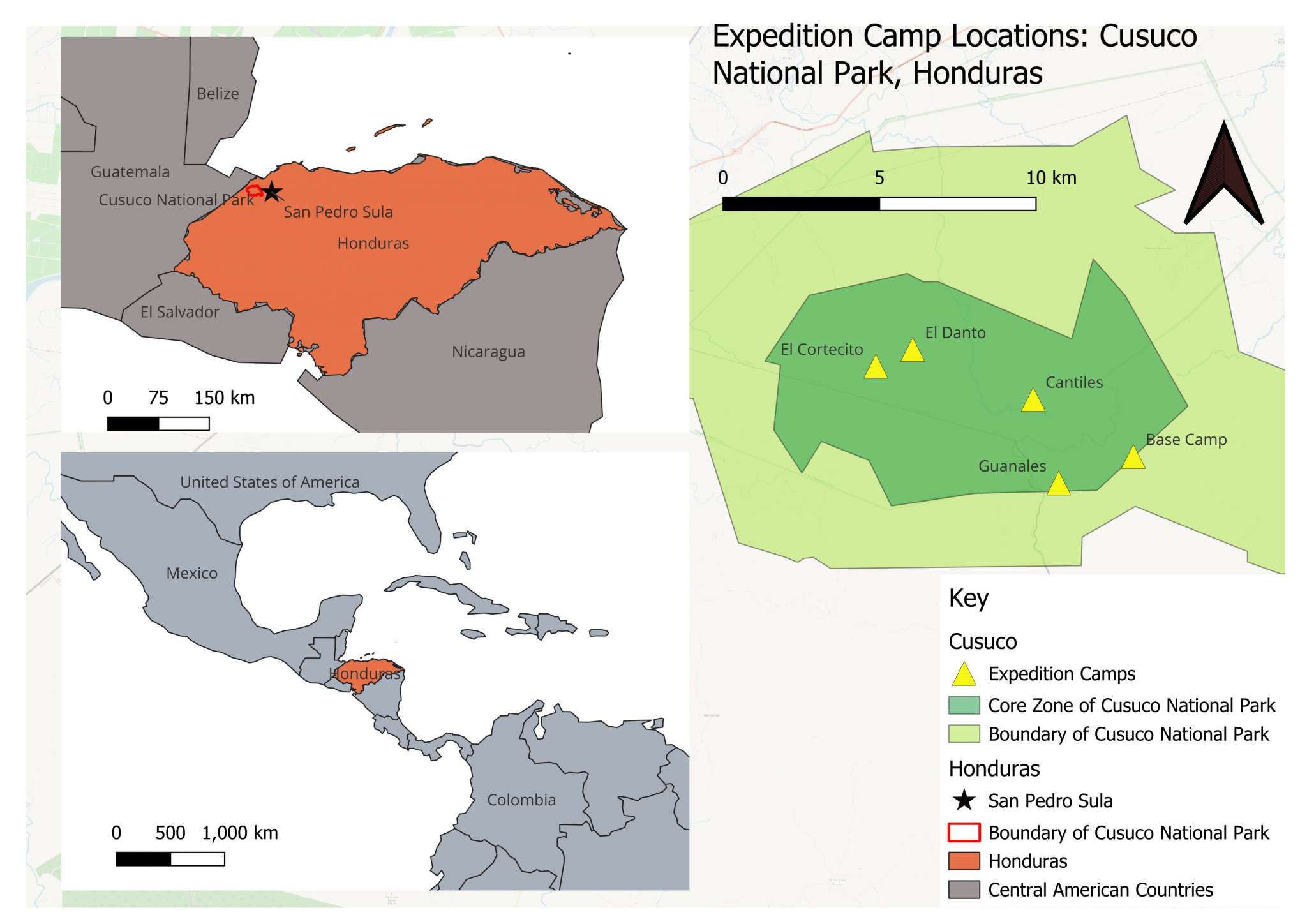
GIS stands for Geographic Information System, and may be something you’ve heard of if you’re studying an environmental subject. It is software which we use to visualise data using maps, and to analyse it to find geographical patterns.
We take “spatial” data about where things are and link that with “attribute” data, which describes what those things actually are. For example, a supermarket would have the spatial data telling us where it is, and the attribute data telling us it’s a supermarket! We can then use GIS to manage, analyse and visualise the information about a location. The types of data that we can put into GIS can include ecological/environmental data (such as vegetation cover types, species records and waterways), as well as demographic/social data (such as voting patterns and population densities). The mixture of both spatial and descriptive data means we can use GIS to create really interesting maps that provide insight into problems and future decision-making.

Why is GIS helpful?
Careers
Many fields use GIS – medical researchers, urban planners, engineers and cartographers would benefit from experience with GIS as well as ecological consultants, hydrologists, conservationists and many more roles.
You may notice GIS being listed as either an essential or desirable skill on many job applications you come across, usually either as ArcGIS or QGIS. If you have only ever used the one they don’t mention (if they ask for ArcGIS and you have used QGIS), definitely still mention your experience!! They have different interfaces so it will take a little time to find the tools you are looking for, but employers will still value your experience with GIS software and your understanding of how it can be used, your experience of analysing geospatial data and with presenting it. GIS is a really key skill for a wide range of careers, and it doesn’t take particularly long to get familiar with the basics. Why not try giving it a go?
How can I learn GIS?
Many educational institutions now teach GIS skills as an essential part of environmental and geographical courses. Even if this is this case for you, you can really never have too much experience with it as the software is much easier to use if you are familiar with it. Many career pathways ask for GIS experience, and being able to show that you’ve gone out of your way to learn and continue using it will help show how proactive you are.
There are many online courses and places to practice your skills. Opwall offers a free short course in using GIS to visualise ecological data, with a focus on making the software accessible and on creating professional maps as an output. This is essential if you want to publish any maps you create! Find more about the Opwall course here – https://www.opwall.com/online-courses/
Now go out there and start making maps!


© 2026 Operation Wallacea Ltd. Website by Yello Media.
Social Media Links